Digitalní archív orienťáckých map pro Eva Jurenikova
|
Přihlásit
Všichni uživatelé
|
Jazyk:
Česky
Česky
Dansk
Deutsch
Eesti
English
Español
Français
Italiano
Magyar
Norsk
Polski
Português
Русский
Svenska
Türkçe
Український
|
DOMA 3.0.10
Zobrazit náhled na Google mapě
Skýt náhled na Google mapě
|
Otevřít v Google Earth
|
Zpět
<< Pair exercise Aydat (19.03.2011)
|
3 loops Montlosier (20.03.2011) >>
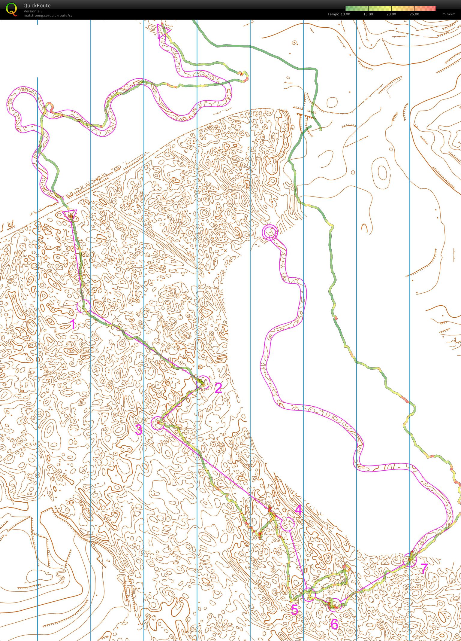
Jegor's map from night training with Thierry, Aydat (19.03.2011)
Kategorie:
Training
Mapa/oblast:
Clermont-Ferrand
Země:
France
Skutečná délka:
6.41 km
Čas:
76:17
3D Rerun
Jegor's 4th training that day. No controls in the forest. The corridor is very narrow. I think there are only a few orienteers in the world who can handle such a course when it is dark.
Zobrazit komentáře
Skrýt komentáře
(
0
)
Napiš komentář
Jméno:
Email:
Ulož
 Česky
Česky Dansk
Dansk Deutsch
 Eesti
Eesti English
 Español
 Français
 Italiano
 Magyar
 Norsk
Norsk Polski
 Português
 Русский
 Svenska
 Türkçe
 Український